Aqua Map USA Marine GPS 8.4
Paid Version
Publisher Description

An app to satisfy all your Fishing and Boating's needs, developed with the help of expert boaters. Download the best up-to-date Nautical Charts to safely enjoy the new boating season. With the Aqua Map Master transform your device in a real ChartPlotter.
►► Features:
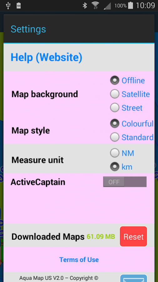
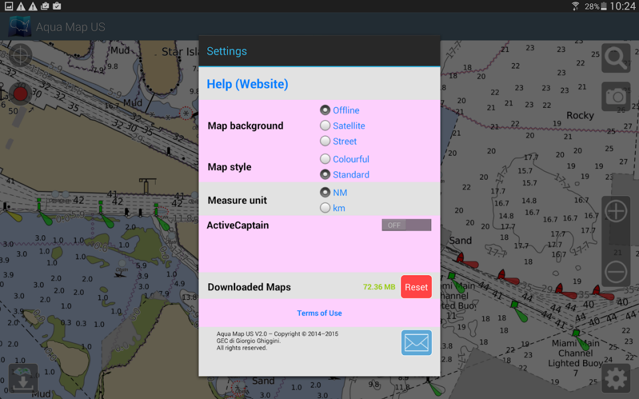
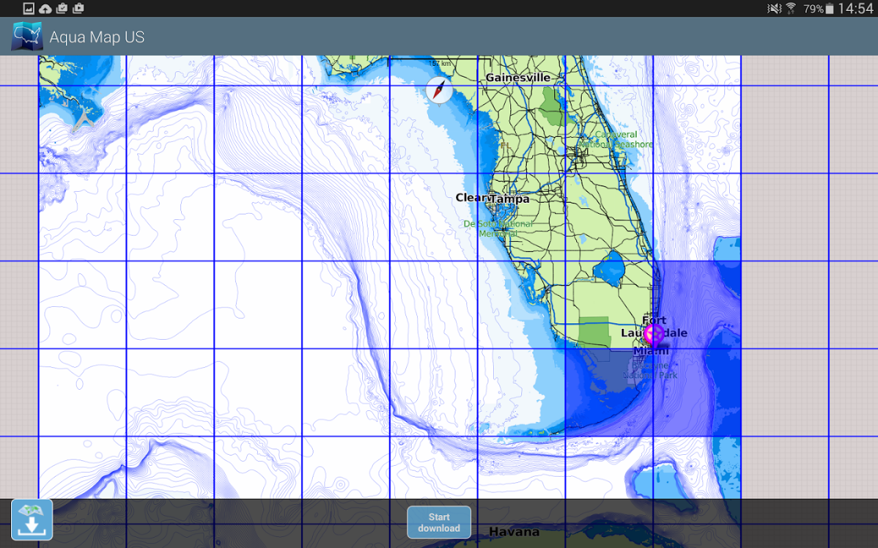
• Download the maps on the device for offline usage
• Plan and navigate your ROUTE with real-time information on next waypoint
• Anchor alarm with advanced configuration
• Tides & Currents prediction and simulation
• Overlay the USACE surveys on top of your charts
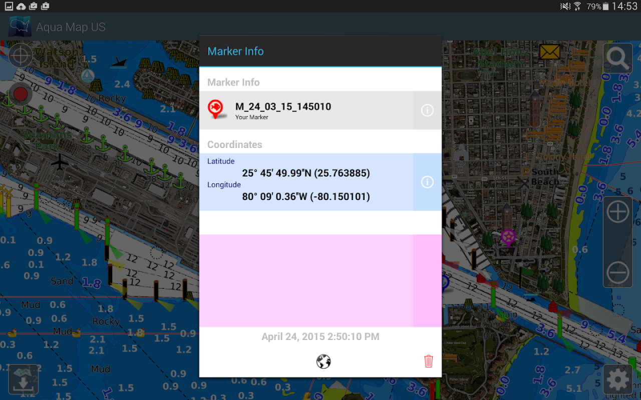
• Share and load tracks, markers and routes (KMZ and GPX)
• ActiveCaptain & Waterway Guide community integration
• Connect your NMEA devices through WiFi
• Powerful search with advanced settings
• Display AIS info from external devices with automatic collision detection
• Expand your horizons with mapXpan (patent pending)
• Overlay the Satellite images on your map
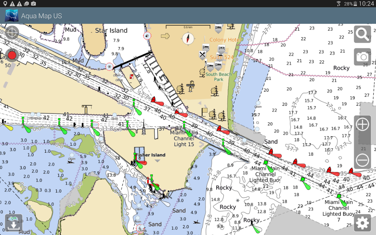
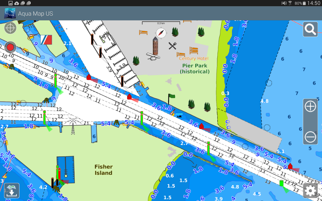
• Measure distances on the map
• Query map objects at your finger tip
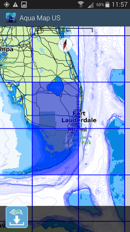
► MAPS
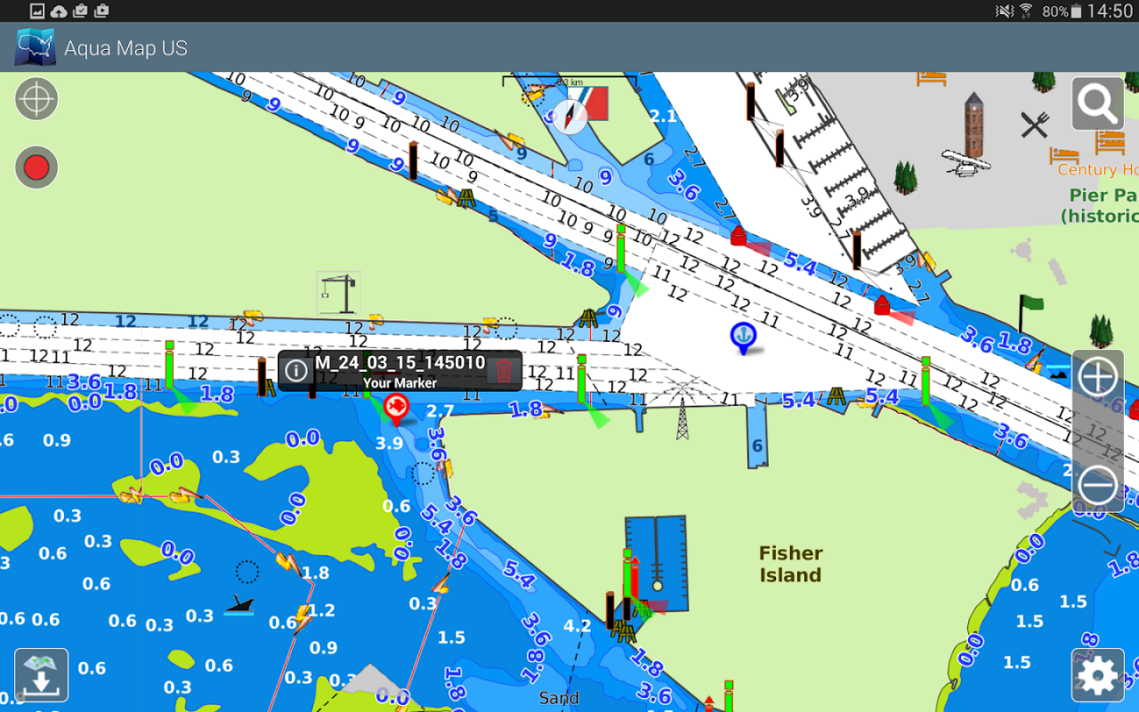
Aqua Map uses only official Nautical charts with depth contours, buoys, lights, etc. to enjoy the best boating experience. You can download the maps at home within your device and use them on the boat offline (no more Internet connection required). Our charts are derived in part from material obtained from: NOAA, CHS, BA, BSH, IIM, CNIG, AHS, NLHO, Explorer, etc.
Available areas: US, Canada, Bahamas, Caribbean, Bermuda, Brazil, Argentina, UK, Ireland, France Med, Spain, Portugal, Italy, Germany, Netherlands, Belgium, Croatia, Estonia, Malta, Australia, New Zealand, Seychelles, Maldives, Emirates, South Africa.
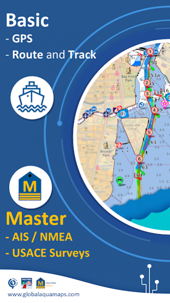
► ROUTES and WAYPOINTS
Plan your trip, insert and edit waypoints. Navigate your route and monitor distance, time (ETA) and direction toward your next waypoint or your final destination.
► ANCHOR ALARM
This function will check in realtime your GPS position against your anchor position previously defined. An acoustic and visual alarm will run as soon as your GPS position is out of the preferred range.
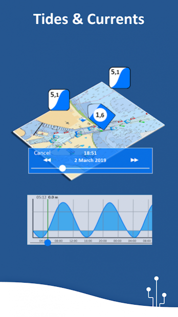
► TIDES & CURRENTS
You can calculate the prediction for more than 6800 stations in the US & Canada. You can also have a simulation of the T&C trend on the map.
► LOADING and SHARING
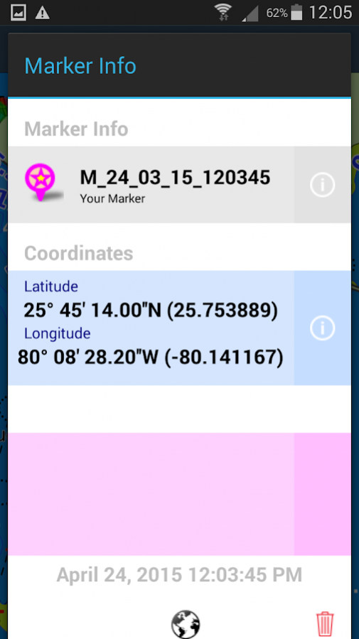
You can share your favorite's markers or send an email with your last daily track. Not only, you can also load any KML, KMZ, GPX (also zipped) found in internet or received from your friends.
► ActiveCaptain
Join the community of more than 100.000 boaters who write reviews, update data and provide up to date hazard information.
Read and contribute reviews and rating about marinas, shared local boating knowledge, anchorage and hazards
► Waterway Guide
Marinas, hazards, anchorages, bridges, free docks and much more to cover the entire US coastline.
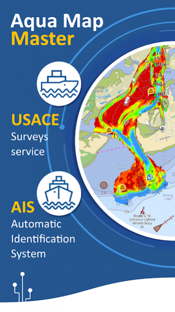
► Aqua Map Master
With this subscription you will access a set of advanced functions that will transform your device in a real ChartPlotter (.. and more).
Connect your NMEA devices through the WiFi and use their data for all the App functions (eg Anchor Alarm), download and display the last USACE surveys, display the AIS targets on the map with automatic collision detection.
► TYPE OF PURCHASES
- Unlimited: you can download and update your charts forever.
- Subscription: it is a one year auto-renewable subscription, it will automatically renews unless auto-renew is turned off at least 24-hours before the end of the current period. Subscriptions may be managed by the user and auto-renewal may be turned off by going to the user's Account Settings after purchase.
For more information please visit our website www.globalaquamaps.com
or send us an e-mail at support@globalaquamaps.com
About Aqua Map USA Marine GPS
Aqua Map USA Marine GPS is a paid app for Android published in the Geography list of apps, part of Education.
The company that develops Aqua Map USA Marine GPS is GEC srl. The latest version released by its developer is 8.4.
To install Aqua Map USA Marine GPS on your Android device, just click the green Continue To App button above to start the installation process. The app is listed on our website since 2020-03-10 and was downloaded 5 times. We have already checked if the download link is safe, however for your own protection we recommend that you scan the downloaded app with your antivirus. Your antivirus may detect the Aqua Map USA Marine GPS as malware as malware if the download link to com.gec.MarineApp.WorldViewer is broken.
How to install Aqua Map USA Marine GPS on your Android device:
- Click on the Continue To App button on our website. This will redirect you to Google Play.
- Once the Aqua Map USA Marine GPS is shown in the Google Play listing of your Android device, you can start its download and installation. Tap on the Install button located below the search bar and to the right of the app icon.
- A pop-up window with the permissions required by Aqua Map USA Marine GPS will be shown. Click on Accept to continue the process.
- Aqua Map USA Marine GPS will be downloaded onto your device, displaying a progress. Once the download completes, the installation will start and you'll get a notification after the installation is finished.
